Vast virgin forests of birch trees and Japanese larch trees
Kamikochi is a small basin, 1,500 meters above sea level on the upper stream area of Azusa-gawa River, which runs through the western part of Nagano. The Hodaka Mountains, Yake-dake Mountains and Jonen Mountains surround Kamikochi. It was Walter Weston, a British missionary and mountain climber who introduced this place to the world in the 19th century and since then many climbers have come to know about this place. Kamikochi is one of the most scenic spots in Japan and belongs to Chubu-sangaku National Park.
 |
The whole area is covered with virgin forests of birches, Japanese larch trees and Japanese hemlocks. Taisho-ike Pond, Tashiro-ike Pond and Myojin-ike Pond are scattered in the forest and produce a beautiful landscape by reflecting the high-rising mountain peaks. Taisho-ike Pond presents a very special scene. In the early 20th century, Mt. Yake-dake erupted and dammed Azusa-gawa River to form Taisho-ike Pond, where trees stand decayed in the blue water. The young leaves of birch trees are so beautiful in June that they are called "light green mist", and attract many tourists. The foliage is at its peak in October and many visitors come to admire their beauty. |
|
What we could
see |
|
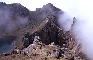 |
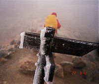
The peak started gradually to get covered by
mist and fog and was invisible from half of the trip. As higher we came,
as colder and inhospitable it was. |
|
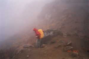
Right side: after half an hour walk |
|
 |
|
 |
|
|
First rest after we stepped over the peak |
The sun gave a mysterious light to the close mountains |
 |
|
|
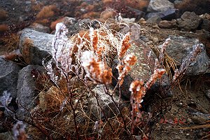
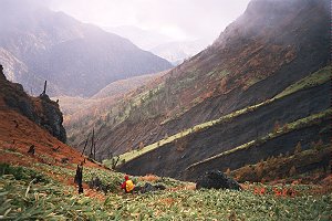
The flow of the lava still is visible and stones and plants seem to be frozen since the last eruption in 1995. |
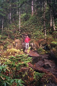
The way down from Yakedake to Kamikochi and the Azusa river valley showed bizarrely formed landscapes. |
 |
|
|
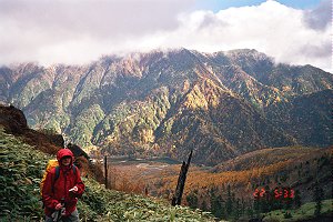
The golden forest with Azusa river and Okuhotaka |
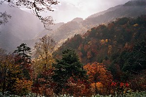
Autumn forest wit sunlight in the mist |
|
|
How to reach the mountains around Kamikochi |
|
From Shinjuku Station, 2 hours 40 minutes by JR Chuo Honsen Limited Express to Matsumoto Station. |
From Matsumoto Station, 30 minutes to Shin-shimashima Station by Matsumoto Dentetsu Line. The bus from Shin-shimashima Station to Kamikochi takes 1 hour 7 minutes. |


www.volcanolive.com
Yake-dake Volcano
Honshu, Japan
36.22 N, 137.58 E
summit elevation 2455 m
stratovolcano
A hydrothermal eruption killed 2 people in 1995 at Yake-dake volcano.
Phreatic eruptions at were common at Yake-dake from 1907 to 1939.
Eruptions of Yake-dake Volcano
1995, 1962-63, 1939, 1935, 1932,
1931, 1930, 1929, 1927, 1927, 1924-26, 1923, 1922, 1921,
1920, 1919, 1918,
1917, 1916, 1915, 1913, 1912, 1911, 1910, 1907-09, 1585, 686.